
Overview
The Dynamic Forms feature allows field technicians to quickly create and fill forms directly from GIS elements on the mobile app. This improves efficiency by reducing manual data entry, leveraging existing ESRI data, and ensuring accurate information is captured on-site.
Key benefits:
-
Save time by auto-populating forms using existing GIS/ESRI data.
-
Reduce errors caused by manual typing.
-
Create forms directly from the map without leaving the app.
-
Ensure all required fields are captured, even for newly discovered assets.
What's New
With the latest update, you can:
-
Create Dynamic Forms from GIS Elements:
-
Select a GIS element on the map and tap “Create Dynamic Form” to create directly the dynamic form.
-
Forms are compatible with Feature Server and Map Server layers.
-
-
Auto-Populate Forms Using ESRI Attributes:
-
Use pre-configured templates and ESRI expressions to automatically fill standard fields.
-
Fields without matching expressions remain empty, ensuring only accurate data is captured.
-
How to Use
-
Open the mobile app and navigate to the map.
-
Tap on any GIS element to select it.
-
Once selected, a “Create Dynamic Form” button appears.
-
Tap “Create Dynamic Form”.
-
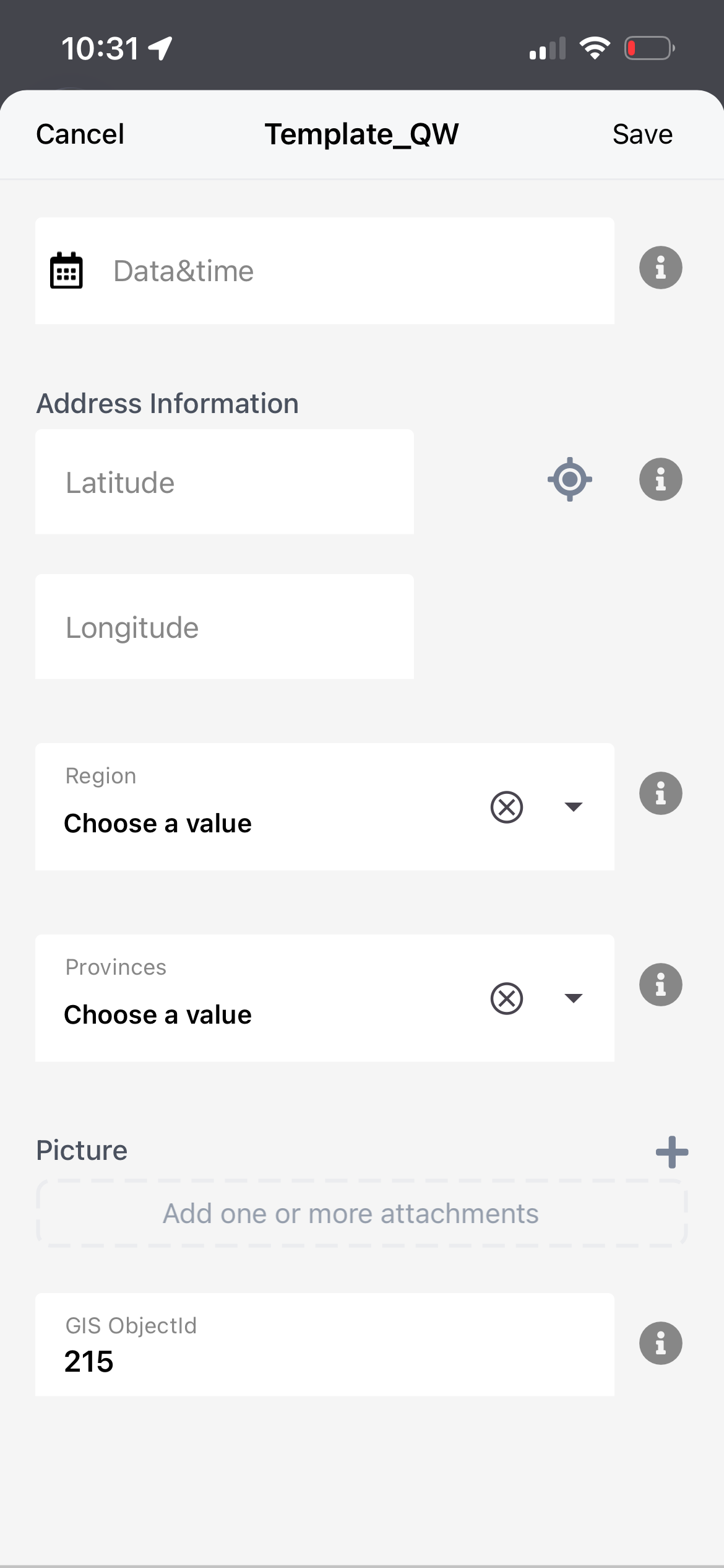
A new form opens, linked to the selected GIS feature.
-
Choose a template, that was configured on the server side with the expression node
-
Fields defined in the template expressions will be filled automatically.
-
Fields without matching expressions will remain empty.
-
Once complete, tap Submit to save the form.
-
The form is linked to the GIS element and synced with backend systems.
.png?cb=4b93d1f141064105496bab2b94f468a4)
Auto-filling GIS Object Attributes on Server Side
To automatically populate a field with information from a GIS object from the mobile side, a server-side configuration must be defined in the template.
Follow these steps:
-
Open the template in edit mode.
-
Create a new node.
-
Set the node type Text or Number.
-
In the Initial Value field, enter the following expression:
#gis.attributes["OBJECTID"]
When the template is opened, the system automatically retrieves the OBJECTID attribute from the selected GIS object and fills the node with this value.
Notes
-
The backend handles all ESRI data retrieval, validation, and node linking. The mobile app only handles the form creation and UI flow.
-
Ensure templates are configured correctly to maximize the auto-population of fields.
-
This feature works for both Feature Server and Map Server layers.
GIS-Based Template Filtering
When a user creates a new Dynamic Form directly from a GIS element, the template selection popup will display only templates associated with that GIS context by default.
Users will also have the option to enable a “View All” filter to display the complete list of available templates if needed.
Templates not configured for GIS usage will remain hidden unless the “View All” option is selected.